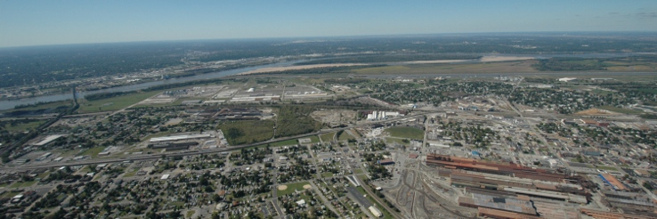


Southwestern Illinois Flood Prevention District Council
 The Southwestern Illinois Flood Prevention District Council (FPD Council) was formed in July 2009 by Madison, Monroe and St. Clair counties in direct response to the Federal Emergency Management Agency’s (FEMA) announcement of its intention to deaccredit the 74-mile levee system protecting the St. Louis Metro East region.
FEMA’s decision would effectively designate substantial portions of the American Bottom area of Southwestern Illinois as a Special Flood Hazard Area (SFHA) on new flood insurance rate maps, with devastating economic impact on our region. Recognizing the urgency of this situation, regional leaders successfully sought authorization from the Illinois General Assembly to impose a ¼ percent sales tax to pay for any necessary improvements to the levee system and created independent Flood Prevention Districts (FPDs) within each county with the authority to collect the tax.
The FPD Council was formed by the three county FPDs as a joint venture to oversee the improvement of the Metro East levee systems so they can continue to protect the lives, property and the economic vitality of the St. Louis Metro East region.
The Council’s website is a good place to keep up with the project. The News and Commentary section shown below discusses the latest developments on the project and related issues in the Metro-East (older posts are shown in the project blog located on the left side of the homepage . The document center page is a portal to the latest materials that are distributed at FPD Board meetings, important correspondence and other useful documents.
Latest News and Commentary
Flood Prevention Sales Tax Receipts Continue to Increase
3.6.2023
With the State of Illinois passing the “Leveling the Playing Field Act” in 2021, the Council’s sales tax receipts have increased from $12.1 million in 2020, to $15.9 million in 2021, and $16.9 million in 2022. These additional funds will be needed to cover projected increased costs due to COVID, inflation, and lengthy reviews by the Corps of Engineers . At this time, it is anticipated there will be sufficient funds to achieve the Authorized Level of Protection.
Council Awards Third Authorized Level Construction Project
8.17.2022
At the August meeting the third Authorized Level Project being built by the Council was awarded. Bid Package #11 – Underseepage Controls from 774+00 to m889+00 in the Metro East Sanitary District, was awarded to Keller Construction from Glen Carbon, Illinois for $11,665,066.40. The engineers’ estimate was $12,000,000 including contingencies.
Metro East Levee Systems Accreditation Celebration
4.27.2022
With the receipt of the East St. Louis/MESD letter of continued accreditation, accreditations has been achieved for all of the Metro East Levee Systems. between Alton and Columbia. To celebrate this outstanding achievement, the Leadership Council Southwestern Illinois held a press conference and Accreditation Celebration at America’s Central Port on April 27, 2022.
East St. Louis/MESD Levee System Receives Continued Accreditation
4.26.2022
FEMA issues a letter of continued accreditation stating the provisions of 44 CFR Section 65.10 have been met for the East St. Louis/MESD Levee System. FEMA letter can be found in Document Center.
Upper Wood River Levee System Receives Continued Accreditation
3.29.2021
FEMA issues a letter of continued accreditation stating the provisions of 44 CFR Section 65.10 have been met for the Upper Wood River Levee System. FEMA letter can be found in Document Center.
Wood River East & West Fork Levee System Receives Continued Accreditation
3.25.2021
FEMA issues a letter of continued accreditation stating the provisions of 44 CFR Section 65.10 have been met for the Wood River East & West Fork Levee Systems. FEMA letter can be found in Document Center.
Lower Wood River Levee System Receives Continued Accreditation
3.25.2021
FEMA issues a letter of continued accreditation stating the provisions of 44 CFR Section 65.10 have been met for the Lower Wood River Levee System. FEMA letter can be found in Document Center.
Americans Bottom Levee (Risk) Communication Meetings
April 2020
Since last July, the Council with the USACE Levee Safety Program and the St. Louis Metro East Levee Issues Alliance has been holding public informational meetings assessing and communicating the benefits and risks of living behind levee systems. A copy of the presentation can be found in the document center section. In additional, the Leadership Council of Southwestern Illinois has issued a video, which also relates to the improvements that have been made to the American Bottom Levee System. The video can be accessed at https://vimeo.com/421607118
Savings from Refunding of Series 2010 ABC Bonds Greater Than Anticipated
1.16.2020
In September 2019, when Columbia Capital Management, the Council’s Financial Advisor, presented the Council with a bond refunding alternative, debt service savings where projected to be in the $8 to $12 million dollar range. When the sale occurred on January 16, 2020, with market conditions being most favorable, the refunding produced a debt service savings of $13.2 million dollars through the life of the bonds, or about $775,000 annually.
Council Awards First Two Authorized Level Construction Projects
1.15.2020
At the December 2019 and January 2020 meetings, the first two Authorized Level Projects being built by the Council were awarded. In December, Bid Package #18 – Underseepage Controls from 1207+00 to 1352+00 in the Metro East Sanitary District, was awarded to Keller Construction from Glen Carbon, Illinois for $4,798,418.20. In January, Bid Package #14A – Underseepage Controls from 861+00 to 863+00 in the Metro East Sanitary District, was also awarded to Keller Construction for $905,000.00. Both bids came in under the engineers’ estimate.
Prairie Du Pont/Fish Lake Levee Systems Receive Continued Accreditation
11.14.2019
FEMA issues a letter of continued accreditation stating the provisions of 44 CFR Section 65.10 have been met for the Prairie Du Pont & Fish Lake Levee Systems. FEMA letter can be found in Document Center.
April/July 100-Year Flood Event
7.31.2019
On June 8th the elevation of the Mississippi River at the St. Louis gauge reached 49.58 feet. This was the second highest crest ever recorded, and follows the fourth highest crest of 42.52 feet on January 1, 2016 and the seventh highest crest of 41.70 on May 6, 2017. The crest of 49.58 feet was a 100-Year Flood event. In addition, the Mississippi River was above flood stage for a record 126 consecutive days, surpassing the 1993 flood event of 104 days. All of the Council’s improvements performed as intended with the Metro East American Bottom levees handling the event much better than before. These flood events and their longevity continue to reflect the need for the work the Council is doing.
Wood River Amended Project Partnership Agreement
7.26.2019
An amended Project Partnership Agreement between the Corps of Engineers, the Wood River Drainage and levee District and the Council executed providing eligibility for credit towards the non-Federal share of the Wood River Levee System Design Deficiency Corrections.
MESD Work In-Kind Credit
5.2.2019
Corps of Engineers approves $12,415,405.70 of Work In-Kind credit for work completed by the Council that is integral to the East St. Louis Design Deficiency Corrections Project.
FEMA Indicates Structural Requirements met for East St. Louis and Vicinity Flood Protection Project
4.29.2019
In a letter to the Corps of Engineer, FEMA has indicated “the minimum criteria outlined in the structural requirements of 44 CFR Section 65.10(b)(1) – (b)(5), have been met for the MESD Levee System. FEMA will be working with the Corps of Engineers, MESD, and impacted communities regarding additional coordination involving interior drainage and Operation & Maintenance Plans. FEMA will issue new maps in the future which will reflect the continued accreditation of the MESD Levee System. The MESD Levee System has been accepted as structurally sound. FEMA letter can be found in Document Center.
MESD Amended Project Partnership Agreement
4.1.2019
An amended Project Partnership Agreement between the Corps of Engineers, the Metro East Sanitary District and the Council was executed providing eligibility for credit towards the non-Federal share of the East St. Louis Design Deficiency Corrections.
Wood River Work In-Kind Credit
1.10.2019
Corps of Engineers gives preliminary approval for $16,041,496.10 of Work In-Kind credit for work completed by the Council that is integral to Wood River Levee System Design Deficiency Corrections Project.
MESD Levee System Receives FY 2019 Work Plan Funds
11.21.2018
The Corps of Engineers announces the receipt of $95,198,450 FY 2019 Work Plan Funds for the East St. Louis Design Deficiency Corrections. With the work completed to date and the current construction estimate, these funds should be sufficient to complete the Authorized Level of Protection Projects in the MESD Levee System.
Wood River Authorized Level Costs
11.5.2018
The Corps of Engineers issues their certified cost estimate of $85,290,000 for the Wood River Authorized Level Improvements. Previously, the Wood River Levee System Reevaluation Report for Design Deficiency Corrections approved in 2011 identified an estimated cost of $51,890,000.
100-Year Certification Construction Completed
2.9.2018
All of the construction packages for the 100-Year Certification finalized and completed with all retainage released, with a total final cost of $74,629,856.18 for the ten construction packages. Two record flood events, in the last two years, extended construction longer than originally anticipated. With the flood protection improvements being completed, the American Bottom area is now, by today’s engineering standards, protected from a 100-Year Flood event.
MESD Levee System Submitted to USACE
12.20.2017
On December 20th, at the Council’s December meeting, Amec Foster Wheeler submitted the required information on the MESD Levee System to the Corps of Engineers. The MESD Levee System located in the Counties of Madison and St. Clair will be the fifth and final levee certification package to be submitted to FEMA. The Corps of Engineers will be submitting the National Flood Insurance Program (NFIP) Levee System Evaluation Report (LSER) certification package to FEMA in May. FEMA review and approval will take at least ten to twelve months with accreditation currently anticipated to occur in late spring of 2019.
Lower Wood River Levee System Submitted to FEMA
10.17.2017
On October 17th, Amec Foster Wheeler submitted the Council’s fourth levee certification package to FEMA. This submittal involved the Lower Wood River Levee System located in Madison County. Amec Foster Wheeler will be submitting required information on the MESD Levee System to the Corps of Engineers by the end of the year, with the Corps of Engineers submitting to FEMA next March or April. With the recent flood events in Texas and Florida, FEMA review and approval will take at least ten to twelve months. Accreditation is currently anticipated to occur in March or April 2019.
Prairie Du Pont & Fish Lake Levee Systems Submitted to FEMA
7.6.2017
On July 6th, Amec Foster Wheeler submitted the Council’s third levee certification package to FEMA. This submittal involved the Prairie Du Pont & Fish Lake Levee Systems located in Monroe and St. Clair Counties. Next to be submitted is the Lower Wood River Levee System, currently scheduled to be submitted in October.
April/May Flood Event Delays Completion of Final Projects
5.15.2017
On May 5th the elevation of the Mississippi River at the St. Louis gauge reached 41.70 feet. This was the sixth highest elevation ever recorded, and follows the third highest elevation of 42.52 feet recorded less than two years earlier on January 1, 2016. All of the Council’s projects performed as designed and no problems were experienced, which reflects the design and construction management provided by Amec Foster Wheeler and the performance of our contractors. Unfortunately, with the river rising as high as it did, the remaining construction that needs to be completed, such as the East St. Louis 126 Inch Sewer rehabilitation, the lengthy MESD clay cap and the few remaining relief wells in Wood River will be delayed.
Two record events in less than two years, confirm the need for the work the Council is completing for the 100-Year accreditation and ultimately for the 500-Year Authorized Level of Protection.
Corps of Engineers Submits National Flood Insurance Program (NFIP) Levee System Evaluation Report (LSER) for Wood River Upper Levee System to FEMA
3.10.2017
On March 10th the Corps of Engineers submitted the National Flood Insurance Program (NFIP) Levee System Evaluation Report (LSER) certification package for the Upper Wood River Levee System to FEMA. This package includes the Mel Price Lock and Dam area. This is the second of five certification packages to be submitted. The Prairie Du Pont/Fish Lake certification package is anticipated to be submitted by Amec Foster Wheeler in June.
First Certification Package Submitted to FEMA
12.5.2016
On December 5th Amec Foster Wheeler submitted the Council’s levee certification package for the East and West Fork Levee System in Madison County to FEMA. This is the first certification package to be submitted. FEMA review is expected to take four to twelve months with a decision following the FEMA review and resolution of any outstanding issues during review.
East St. Louis 126 Inch Sewer Rehabilitation Project Added to Certification Requirements
11.16.2016
On November 16, 2016 the Council approved the award of a contract for Bid Package #5A with SAK Construction, LLC for the East St. Louis 126 Inch Sewer Rehabilitation and Sluice Gate Replacement for $699,900.00. The sewer owned by the City of East St. Louis and located in the Metro East Sanitary District Levee System was identified to be necessary to achieve certification. The Council, to expedite the project and assist the City of East St. Louis, will complete the project with the City of East St. Louis reimbursing the Council for all design and construction costs over an agreed upon time period.
Council Approves Prairie Du Pont/Fish Lake Levee System Authorized Level Field Investigation and Design Phase I
9.21.2016
The Council continues to move forward with Authorized Level projects by accepting Amec Foster Wheeler’s Prairie Du Pont/Fish Lake Levee System Authorized Level Project Summary Report and Project Cost Estimate at the August meeting, and approving in September a work order for Amec Foster Wheeler to perform the Prairie Du Pont/Fish Lake Levee System Authorized Level Field Investigation and Design Phase I. The work order includes complete Construction Documents and associated Design Services in support of the design and construction of levee improvements throughout the Prairie Du Pont/Fish Lake Levee System.
Authorization of this work order fulfills the Council’s intent, as established by resolution in February 2015, to design the most critical and cost-effective projects throughout the Counties of Madison, Monroe, and St. Clair to restore the federally authorized level of flood protection.
Corps of Engineers to Build Wood River Upper Shallow Cutoff Wall
3.16.2016
With the application of Work In Kind (WIK) credit not being possible until an amendment to the Project Partnership Agreement (PPA) is executed (which could take up to twelve months), the Corps of Engineers has offered to build the remaining phase of the Wood River Upper Shallow Cutoff Wall utilizing only federal funds. The Corps will utilize the Best Value Trade-Off Approach for solicitation of the shallow cutoff wall construction contract.
December Flooding Requires Emergency Operations
1.20.2016
Unusual December flooding created the need for emergency flood event pumping at Pump Stations 5, 9, & 10 construction sites. In addition, the high river delayed the start of the installation of the Reinforced Concrete Pipe (RCP) which is replacing the High Density Polyethylene (HDPE) pipe in Bid Packages #2, #4, & #5. The river elevation will need to fall to an acceptable Corps of Engineers level prior to the installation beginning.
Sale of Series 2015 Sales Tax Revenue Bonds
12.16.2015
The sale of the Council’s 2015 Series AB Bonds was very successful with net proceeds of $25.7 million for the Senior Bonds and $51.8 million for the Subordinate Bonds for a total amount of $77.5 million.
Series 2015 Sales Tax Revenue Bonds Resolution Approved
10.21.2015
Keeping on schedule of having a bond sale accomplished before the end of 2015, the Council approved a resolution providing for the issuance of Sales Tax Revenue Bonds, Series 2015 Senior Bonds and Series 2015 Subordinate Bonds in aggregate principal, not to exceed $100,000,000, for the purpose of performing emergency levee repair and flood prevention in order to prevent the loss of life or property.
Council Approves MESD Levee System Authorized Level Field Investigation and Design
9.16.2015
The Council continues to move forward with Authorized Level projects by accepting Amec Foster Wheeler’s MESD Levee System Authorized Level Project Summary Report and Project Cost Estimate at the August meeting, and approving in September a work order for Amec Foster Wheeler to perform the MESD Levee System Authorized Level Field Investigation and Design. The work order includes complete Construction Documents and associated Design Services in support of the design and construction of levee improvements throughout the MESD Levee System.
Council Approves Wood River Authorized Level Field Investigation and Design
7.15.2015
After accepting Amec Foster Wheeler’s Wood River Authorized Level Project Summary Report and Project Cost Estimate at the June meeting, the Council approved a work order for Amec Foster Wheeler to perform Wood River Authorized Level Field Investigation and Design. The work order includes complete Construction Documents and associated Design Services in support of the design and construction of levee improvements throughout the Lower Wood River Levee System.
Council Approves Bond Financing Schedule and Selects Bond Counsel
5.20.2015
Anticipating a bond sale for the Authorized Level projects before the end of the year, the Council accepted the proposed bond financing schedule prepared by Columbia Capital Management, the Councils’ Financial Advisor. The latest schedule can be found in the document center. In addition, the Council selected Thompson Coburn to be bond counsel.
Lower Wood River Deep Cutoff Wall Rebid
5.20.2015
With the original low bid contractor terminating their contract with the Council, the Lower Wood River Deep Cutoff Wall Project was rebid. The project includes the construction of a cement-bentonite cutoff wall, constructed in panels, approximately 100 ft. – 140 ft. in depth, as well as a protruding clay cap along the riverside of the levee system along the cutoff wall, relief wells, piezometers, and other instrumentation. TREVIICOS South Corporation from Charlestown, Massachusetts was the low bidder in the amount of $13,991,000. Cutoff wall construction is expected to be completed by the end of the year, with site restoration completed by May 2016.
Council Approves Analysis and Planning of the USACE Authorized Level of Protection
4.15.2015
Taking the first step towards achieving the authorized 500-year flood level of protection, the Council approved a comprehensive work order with Amec Foster Wheeler to review specific Authorized Level improvements identified by the Corps of Engineers, all supplemental reports, and pertinent documents to develop a schedule for the design and construction of Authorized Level improvements. Amec Foster Wheeler will also provide program management in support of the design and construction of improvements associated with the USACE Authorized Level Project.
Council Approves Authorized Level of Protection Resolution
2.18.2015
With the Corps of Engineers’ recent decision on the utilization of Project Labor Agreements (PLAs), the Flood Prevention District needed to determine its course of action for achieving the authorized 500-year flood level of protection for the Metro-East area. The Flood Prevention District has accomplished much during its brief existence. The schedule has slipped due to easement obtainment, high river, and weather, but the Council is well on the way of achieving the interim goal of 100-year protection and accreditation by FEMA. All projects should be completed by the end of the year with accreditation to follow in 2016. Current estimates indicate the cost of the projects will come in under the original preliminary costs, and that there may be a fund balance in excess of $15,000,000. In addition, there is the potential to generate another $74.5 million through an additional bond issue. With these funds available for design and construction, much can be accomplished towards the 500-year level of protection. The Metro-East cannot afford to wait for the Corps of Engineers for funding and changing their stance on PLAs. The Flood Prevention District needs to proceed with a cost effective plan, utilizing PLAs, and building the highest priority projects in Madison,Monroe, and St. Clair counties. Therefore, on February 18, 2015, the Council approved a resolution expressing the Official Intent to Restore the Federally Authorized Level of Mississippi Flood River Protection in the Metro-East area. Critical actions identified in the resolution include Design, Funding Strategy, Workforce Policies, Levee Districts Participation, and Corps of Engineers Participation. The full resolution may be viewed in the document center.
Council Approves Final Two Projects
8.20.2014
On August 20, 2014, the Council approved the award of contracts for the final two projects required to achieve FEMA accreditation for the American Bottom area. Kamadulski Excavating from Granite City, Illinois was awarded Bid Package #7A for the construction of the Upper Wood River Shallow (20 ft. – 30 ft. in depth) Cutoff Wall including additional improvements such as a clay cap, piezometers, and a storm water pipe conveyance system in the Wood River Levee and Drainage District for $3,076,208.70 with a completion date of January 30, 2015. Kiewit Infrastructure Corporation from Omaha, Nebraska was awarded Bid Package #7B for the construction of the Lower Wood River deep (100 ft. – 140 ft. in depth) Cutoff Wall including additional improvements such as a clay cap, piezometers, relief wells and inclinometers in the Wood River Levee and Drainage District for $10,613,400.00 with a completion date of June 5, 2015.
Corps Approves Section 408 Review on Final Two Projects
8.15.2014
On August 15, 2014 the Council received preliminary approval of the Section 408 review of projects BP #7A Upper Wood River-Shallow Cutoff Wall and BP #7B Lower Wood River-Deep Cutoff Wall from the U.S. Army Corps of Engineers (USACE). The “streamlined” Sec 408 review which required approval from the Corps Division and Headquarters office , in addition to the local District, was completed in the four month time frame originally promised by the Corps. Constant communication between the Corps and the Council’s Engineer, AMEC Environment & Infrastructure, during the review process allowed for this tight schedule to be met. This also allowed for the bidding process on the two projects to begin while the Section 408 review was performed.
Wood River Cutoff Wall Projects Submitted to Corps of Engineers for Section 408 Review
4.18.2014
On April 18, AMEC, the Council’s Project Engineer provided Project BP #7A Upper Wood River-Shallow Cutoff Wall and Project BP #7B Lower Wood River-Deep Cutoff Wall to the U.S. Army Corps of Engineers (USACE) for a four month “streamlined” Sec 408 review which requires approval from the Corps Division and Headquarters offices. These projects were originally design by AMEC, then given to the Corps for design (due to available funding and review requirements), and then taken back from the Corps (due to the Corps’s unwillingness to incorporate the Council’s policies regarding use of the local workforce and being unable to make a binding commitment to a budget and schedule). These are the last two projects needed to achieve the 100 year level of protection. Utilizing the AMEC design will provide a more definite schedule, cost certainty, and have a greater local economic impact.
Corps of Engineers to Conduct National Flood Insurance Program (NFIP) Levee System Evaluation Report (LSER)
4.10.2014
On April 10, 2014 the U.S. Army Corps of Engineers (USACE) approved the Council’s request of February 20, 2014 to conduct a National Flood Insurance Program (NFIP) Levee System Evaluation Report (LSER) for the Wood River Upper Levee System. The purpose of preparing the LSER is to document the evaluation of an NFIP levee system and indicate the achievement of the 100 year level of protection. This would substitute for the certification required by FEMA, with the report being completed at full federal expense.
Council Approves Completion of Levee Reconstruction Project in the Wood River Drainage and Levee District
3.17.2014
On March 17, the Council authorized an additional $915,384.00 as cost-share funding, matching $1,700,000 of Corps funding for the completion of the Levee Reconstruction project in the Wood River Drainage and Levee District. This last portion of the project consists of completing pump station repairs, gravity drain repair/installation, O & M manuals, as-builts, and project close out. This will complete this project with the Wood River Levee District and the FPD contributing over $12,000,000 towards the project during the last five years. The Corps’ expenditures on this project contribute to achieving the 100-year level of protection needed for the FEMA accreditation.
Council Authorizes Quality Control & Materials Testing Services
2.19.2014
On February 19, the Council authorized ABNA Engineering to perform construction quality control and material testing services for Project BP #3, in addition, to providing similar services on BP #6. The Council, also, authorized Juneau Associates, Inc. to provide construction quality control and materials testing services on BP #2B, BP #4, and BP #5, in addition to providing similar services on BP #2A. Both of these authorizations complement the construction inspection and quality assurance services being performed by AMEC as part of their construction management contract with the Council.
Les Sterman Retires
1.15.2014
As announced last September, on January 15, 2014, Les Sterman, Chief Supervisor of Construction and the Works retired from the Southwestern Illinois Flood Prevention District Council. Les had been at the Council since it was formed in 2009. After many years at East West Gateway Council of Governments, Les offered his assistance in getting the Flood Prevention District Council concept initiated. This eventually led to the approval of a quarter cent sales tax in Madison, Monroe, and St. Clair Counties for upgrading the Metro East levee systems. His accomplishments include organizing the Council, putting a plan together, securing financing, completing the design and securing the needed permits. His efforts of getting individuals, councils, cities and counties working together in one direction is the reason the FPD project is being built on time and within budget. Chuck Etwert, formerly the Assistant Executive Director of the Metropolitan St. Louis Sewer District, will assume the Chief Supervisor position upon Les’s departure.
Council Approves Three More Construction Projects
12.18.2013
On December 18, the Council’s Board of Directors approved three more major construction contracts for improvements in the Metro-East Sanitary District and the Wood River Levee and Sanitary District. Haier Plumbing from Okawville, IL. was awarded Project BP #4 and will be constructing one pump station and installing clay cap, piping, and relief wells in the Metro-East Sanitary District at a cost of $3.19 million. Keller Construction, Inc. from Glen Carbon, IL. was awarded Projects BP #3 and #5 and will be installing blanket drains, earth fill , relief wells, seepage berms, piping , weirs, and rip rap in both Districts at a cost of $18.38 million. There are now six projects under construction with a total cost of $39.0 millions.
Council Decides to Build Major Project Designed by the Corps
11.20.2013
At its meeting on November 20, the Council’s Board of Directors voted unanimously to assume the responsibility for building a “cutoff wall” in the Wood River area that is being designed by the Corps of Engineers. A cutoff wall is a trench adjacent to the levee filled with a concrete-like material, designed to block underseepage during periods of high water. The Council had previously finished the design of the project, but a recent federal appropriation for the project, and the lengthy and unpredictable course of the review of the design by the Corps made it advantageous for the Corps to design and possibly build the project. The Council would pay for about 35% of the cost of the project to match federal funds. However, the Corps was unwilling to comply with the Council’s policies regarding use of the local workforce, and was unable to make a binding commitment to a budget and schedule. Also worthy of note is that work done under contract to the Council is typically costing far less than similar work done by the Corps. The Council has the money from the local sales tax to build the project. These and other factors convinced the Board that the area is best served if federal funds are not used on construction. Although there will be initial delays as our own engineers take responsibility for the final design and an additional Corps review (yes, oddly enough the Corps must do a review of its own design!) there will be more schedule and cost certainty with local control of the project, and the local economic impact will be far greater.
Council Signs Contracts for Two Major Construction Projects and Issues Invitation to Bid for Three More (updated)
10.18.2013
Today, the Council signed contracts with Korte Luitjohan from Highland Illinois to build a pump station in the Fish Lake Levee and Drainage District and with Lane Construction from Shorewood, Illinois to build berms, relief wells and other related infrastructure to control underseepage in the Fish Lake and Prairie DuPont districts. Total cost of this work is over $13 million. At its meeting on October 16, the Council also approved awarding a third contract to build five new pump stations along the levee system in Monroe, St. Clair, and Madison counties. And over the past week the Council issued three more invitations to bid on major construction projects (see sidebar “bid documents” below for details). All of this signals that the project is entering a new phase. Design and permitting are nearly complete and construction is underway. While there have been some delays, the Council is still optimistic that work can be completed by late 2015.
Request for Qualifications for Quality Control, Materials Testing, and Inspection
5.30.2013
As we prepare for the start of construction, the Council is seeking firms to do independent, third-party quality control for construction materials. A request for qualifications with information on this solicitation is now available by clicking on the title in the bid documents sidebar on the left side of our home page. The deadline for submission of statements of qualifications is June 28, 2013 at 5:00 pm local time.
Council Submits Comments to the Corps of Engineers on the Use of Project Labor Agreements
5.10.2013
On May 8, the Council submitted formal comments to the U.S. Army Corps of Engineers regarding the use of a Project Labor Agreement on the proposed project to construct a cutoff wall in the Wood River Drainage and Levee District. This project is expected to cost as much as $21 million and involves the construction of shallow and deep cutoff walls on the river side of the levee. The Council submitted comments documenting the basis for our strong support of the use of this pre-hire agreement with the Southwestern Illinois Building and Construction Trades Council. The agreement has been used successfully on hundreds of public and private construction projects in Metro-East and has been proven to reduce budget and schedule risks by eliminating work stoppages due to labor disputes, while improving management/labor harmony. The use of a Project Labor Agreement on the project has also been endorsed by Illinois Governor Quinn and members of our congressional delegation. A decision by the Corps is expected in early June.
Amendment to RFP for Diversity Program Management Services
5.3.2013
On April 11, 2013 the Council issued a request for proposal from individuals or firms to serve as Diversity Program Manager for the levee improvement project. The RFP contained an incorrect due date for responses to the RFP. Proposals are due on Wednesday May 8, 2013 at 5:00 PM local time.
Council Advertises for Bids on First Major Levee Improvement Projects
5.1.2013
The Council is advertising for bids from construction firms for the first two major projects that are part of the overall levee system improvement project. These projects are on the southern end of the levee system in Monroe and St. Clair counties and consist of constructing a pump station, relief wells, berms, clay caps and other underseepage control features. There will be a pre-bid conference at the Council’s offices on Friday, May 17, 2013 at 1:00 pm and bids publicly opened and read at 2:01 pm on June 11, 2013 at the same location. Further information, including instructions on obtaining the bid solicitation documents, is provided in the announcements available on the Bid Documents section on the left side of this homepage.
Corps of Engineers Calls for Comments on Use of Project Labor Agreement
4.16.2013
The Council has adopted a policy requiring all contractors working on the levee improvement project to use project labor agreements. The PLA is a pre-hire collective bargaining agreement with one or more labor organizations that establishes the terms and conditions of employment for a specific construction project. The advantages of the PLA is that it establishes uniform and fair compensation and working conditions for construction workers on the project, addresses jurisdictional and other disputes that might disrupt the project schedule, and it prohibits any work stoppages. Project Labor Agreements have been used successfully on nearly all major projects, public and private, in recent years in Southwestern Illinois. While we have committed to requiring a PLA on all work done under contract, our policy requires that a PLA be used by contractors employed by the Corps of Engineers for all projects partially funded with local tax money provided by the Council. There is no legal restriction limiting the use of PLAs on federally sponsored projects; in fact, the President has issued an Executive Order encouraging federal agencies to do so. However, the Corps has adopted internal guidance establishing procedures to be used in the contracting process if a PLA is to be considered. The first step in the process is to do a “market study” to solicit comments from the industry on the potential use of a PLA. On April 12 the Corps issued a notice soliciting comments. That notice can be found here. The Council encourages all interested parties to submit comments.
Council Seeks Proposals for Diversity Program Manager
4.11.2013
One of the Council’s major goals is to provide local firms and workers with opportunities to work on the project. As part of our effort to meet that goal, the Council commissioned the preparation of a Minority Business and Workforce Utilization Plan. That Plan was completed by Marks and Associates and adopted by the Board of Directors in December 2012. The Plan called for the Council to engage a diversity program manager to engage and encourage minority businesses and workers to work on the project. The Council has now released a request-for-proposal for Diversity Program Manager services. The Plan is available on the Council’s website and can be downloaded here. The RFP for Diversity Program Manager for the project can be downloaded through the Bid Document section on the left side of our homepage.
Acquiring Property for the Project
4.05.2013
While most of the improvements that are being made to the levee system are being done on property already owned by the affected levee districts, there will be some places where easements may be needed to get equipment and workers to the construction site or where a berm or relief well might need to be placed. In most cases, the owner of the current owner would be able to continue to use the property productively once the project is built. Indeed, the property may become more useful, since the overall objective is to significantly reduce the risk of flooding in the area behind the levee. In a very few cases, the Council may acquire property where it might be needed more permanently, such as for a pump station. We estimate that about 200 parcels may be affected overall.
If you do own property that will be affected by the construction of levee improvements, you can be expected to be contacted over the next few months by our representatives. The value of each parcel is being estimated by an independent team of highly qualified appraisers so that we can make fair offers to affected property owners. Our representatives will individually contact each property owner to begin negotiations.
The start of the property acquisition process is a sign that construction is imminent, which is good news. Because this project is so critical to public safety, to the area’s economy and to the interests of all property owners behind the levee, we hope that this process will go smoothly and provide a mutual benefit to all parties.
Important Milestones
4.04.2013
One of the most time consuming and often frustrating parts of a project like ours is the process of securing the necessary permits, permissions, and approvals from federal, state, and local governments prior to any construction taking place. Especially when working in environmentally sensitive areas and on facilities that serve a critical public safety function, every precaution is taken both to avoid lasting disruption and protect the public. There is a legally mandated role for the Illinois Environmental Protection Agency to assure that water quality is not compromised. The Corps of Engineers has the primary oversight role on plans to mitigate any damage to wetlands. Lastly, the Corps of Engineers gives permission to make any alteration to a Federal levee.
On March 4 the Illinois Environmental Protection Agency issued the project a water quality certification under Sec. 401 of the federal Clean Water Act. It has taken over a year to secure this certification, which means that IEPA has come to the engineering judgment that “the proposed project may be completed without causing water pollution as defined in the Illinois Environmental Protection Act, provided that the project is carefully planned and supervised.”
On March 1, 2013, the Corps of Engineers granted a conditional permit under Sec. 404 of the federal Clean Water Act relating to the impacts of the project on wetlands. One major condition of this permit has now been met — the Sec. 401 water quality certification from the IEPA. The remaining major condition is the permission by the Corps of Engineers to make alterations to the Federal levee under the authority of Section 14 of the Rivers and Harbors Act of 1899 (33 U.S.C. Sec. 408).
In essence, now, the last major regulatory hurdle for the project rests with the Corps of Engineers and the Sec. 408 review process. This is a costly, labor and time-intensive process of engineering reviews that has been ongoing for many months. The review is being done in a segmented process, so that approvals can be granted over a period of time, allowing portions of the project to proceed more quickly. The first such approval has been granted (for a pump station in the Fish Lake Drainage and Levee District in Monroe County), and we expect more approvals during the coming months as the entire project is being reviewed.
We are working with our selected provider of wetland mitigation, Republic Services, to finalize the Wetland Mitigation Plan in accordance with the Sec. 404 permit, and to complete and negotiate our contract with them to fulfill the requirements of that plan. We selected Republic last February and have concluded negotiations on contract terms and conditions, but we are awaiting a revised price based on conditions imposed by the Corps as part of the conditional permit.
It has certainly taken longer than we hoped to get to this point, but we are clearly moving toward the day when construction can begin. With further regulatory progress, we hope that happens sometime this summer. The project remains on track for completion in 2015.

